

The top project of the Minister of Housing and Works is coming along beautifully, with some of the most solid construction in the country.
Maria Bird-Browne’s gigantic mansion on Marble Hill, Saint Johns, befits the Labour Queen and her Prime-and-Finance Minister husband.
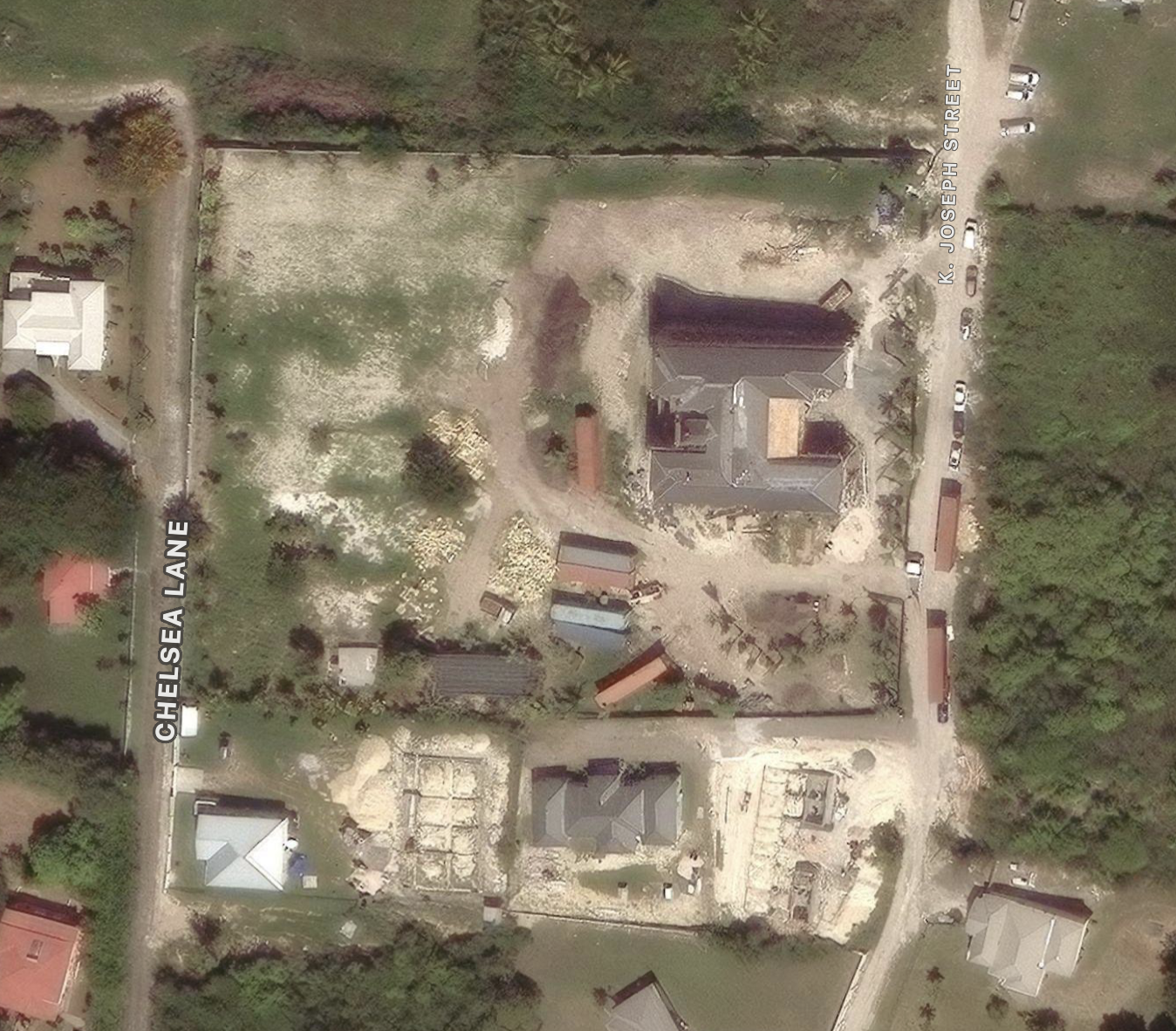
This satellite photo shows the sheer size of the palace, on a generous lot of about 2.8 acres. Scattered shipping containers provide context for scale.
The three story, H-shaped edifice, built atop a bunker of heavy concrete, sits on a high, 84-meter elevation that overlooks Mount Pleasant, Paradise View, Friars Hill, and Dunbars.
Far away from problems with water, sewage, roads, rubbish, and sickness, it can be found by GPS or any online satellite map service at 17°09’07.68″N 61°50’23.40″W.
Can’t pay for legal defence while building such a mansion
“This is what you get when you say you can’t afford to pay a legal bill by the lady, the Russian lady that sued you over the boat, and you come and say now that the government is going to cover the bill,” says a resident in the video below, shot by drone last year.
One of the men in the video calls the Brownes’ project an “armed bunker for when the revolution comes.”
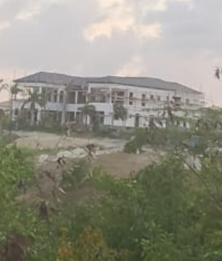
The dramatic photo below shows the hulking structure, which is larger than many social housing projects.

Here some pictures of later construction, taken from different angles (plus satellite images).


Satellite images of the Browne’s housing project, from Google Earth. Location: 17°09’07.68″N 61°50’23.40″W.
These images appear to have been taken about a year ago, in the early stages of construction. Apple Maps has a more recent view.
We’ll start with a distant view to show the area, and zoom in. The site is circled in red.


A more recent view, showing a completed roof, from Apple Maps


Stills from the drone video, 10 months ago


Leave a Reply